 This page's pick
Guides
Language
EnglishCurrency
US dollar · $Your currency applies on GetYourGuide too.
Guide · Waterfalls
Doi Inthanon waterfalls, from Wachirathan to Mae Ya
The Doi Inthanon waterfalls line the road up the mountain, from a family swimming spot near the gate to a long staircase of rock in the south. Here is how they differ.
Check availabilityfrom $39 · free to cancel
Editorial team, trekkingtourchiangmai.comUpdated October 27, 2026Read time: 6 min35 sources
Quick answer, by fall
A mountain made of water
Doi Inthanon's waterfalls exist because the mountain collects so much rain. The park service gives average annual rainfall of 2,000 to 2,100 millimeters and calls the park a significant catchment for the Ping River, the source of the Mae Klang, Mae Ya, Mae Wang and other streams.78 Those streams drop off the mountain in a series of falls, many of them right beside the road.
The main road into the park, Highway 1009, climbs from Chom Thong and enters the park at milestone 8 by Mae Klang Waterfall.9 Most of the falls on a day trip sit along this road and are marked by their milestone, which makes a self-drive circuit easy to plan. A few, such as Mae Ya in the south and Mae Pan in the west, lie on side roads.
Flow changes with the season. In the rainy months the falls are at their loudest and widest, the plunge pools churn and some paths close; in the dry months they shrink, but the water runs clearer and the rocks are easier to walk on. Pick your month with that trade in mind, and read the weather page for the park service's description of the seasons. A trip in the first weeks after the rains end often gives you both: full falls and drier paths.
Wachirathan Waterfall on Doi Inthanon
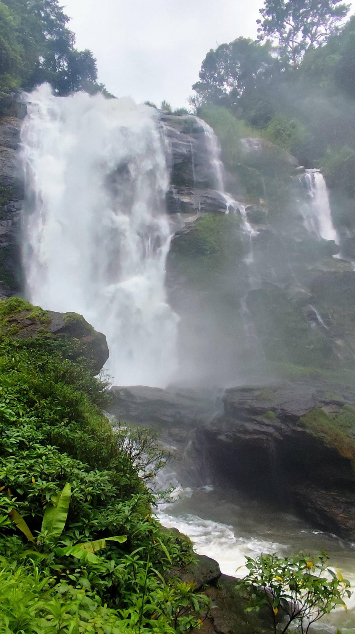
Wachirathan Waterfall on Doi Inthanon is the fall most tours stop at. On the Mae Klang Creek, it drops around 70 to 80 meters at an elevation of about 750 meters.1 It was once called Tat Khong Yong and was renamed in honour of Crown Prince Maha Vajiralongkorn.13
It sits 81.2 kilometers from Chiang Mai at milestone 20 of Highway 1009, about 250 meters down a winding side road.2 There are restaurants, shops, separate restrooms and a gravel car park for around 50 vehicles.10 On a sunny day, the park service notes, a rainbow forms over the stream where the light catches the spray.14
The spray is the other thing to plan for. Stand near the viewing points in the wet season and you will be soaked within a minute, so keep phones and cameras in a bag until you are ready. The most reviewed Doi Inthanon tour ends its day here before the drive back to the city.
The falls compared
Doi Inthanon waterfalls at a glance
| Waterfall | Height or tiers | Where | Swimming | Getting there |
|---|---|---|---|---|
| Wachirathan | 70 to 80 m | Milestone 20 | Not stated | 250 m down a side road |
| Mae Ya | 30 tiers, 260 m | South of the park | Not stated | 14 km side road |
| Mae Klang | Large pools | Eastern edge | Outside the rains | Off the road near the gate |
| Sirithan | 2 tiers, 50 m | Milestone 22 | Not stated | By the road |
| Pha Dok Siao | 10 tiers | By headquarters | Not stated | 1 km on foot |
| Siriphum | Twin falls | Near Khun Klang | Not stated | 1 km through gardens |
Heights, tiers, locations and access as the park service describes each fall; swimming notes where it gives one.123164115612
Tours that stop at the falls
Three days that include a waterfall
This page's pick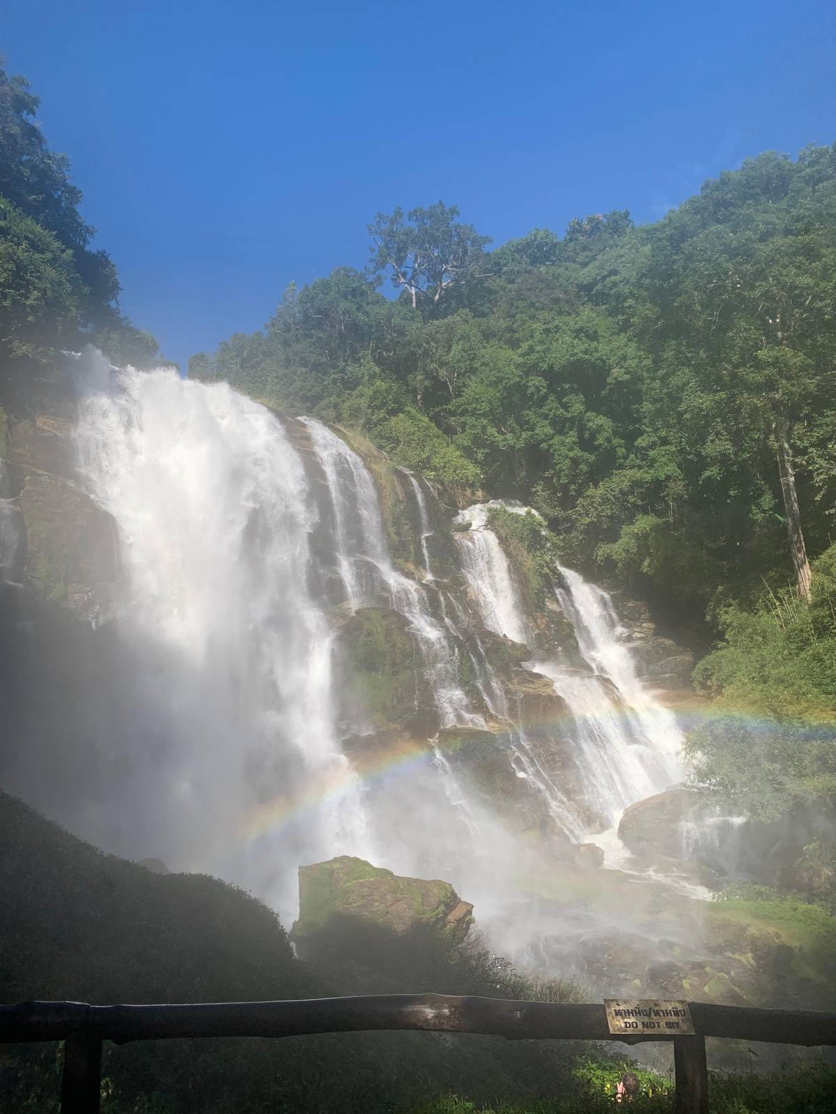 On foot
 Shared van
Decision helper
Which fall should you prioritise?
Start from what you want out of the stop.
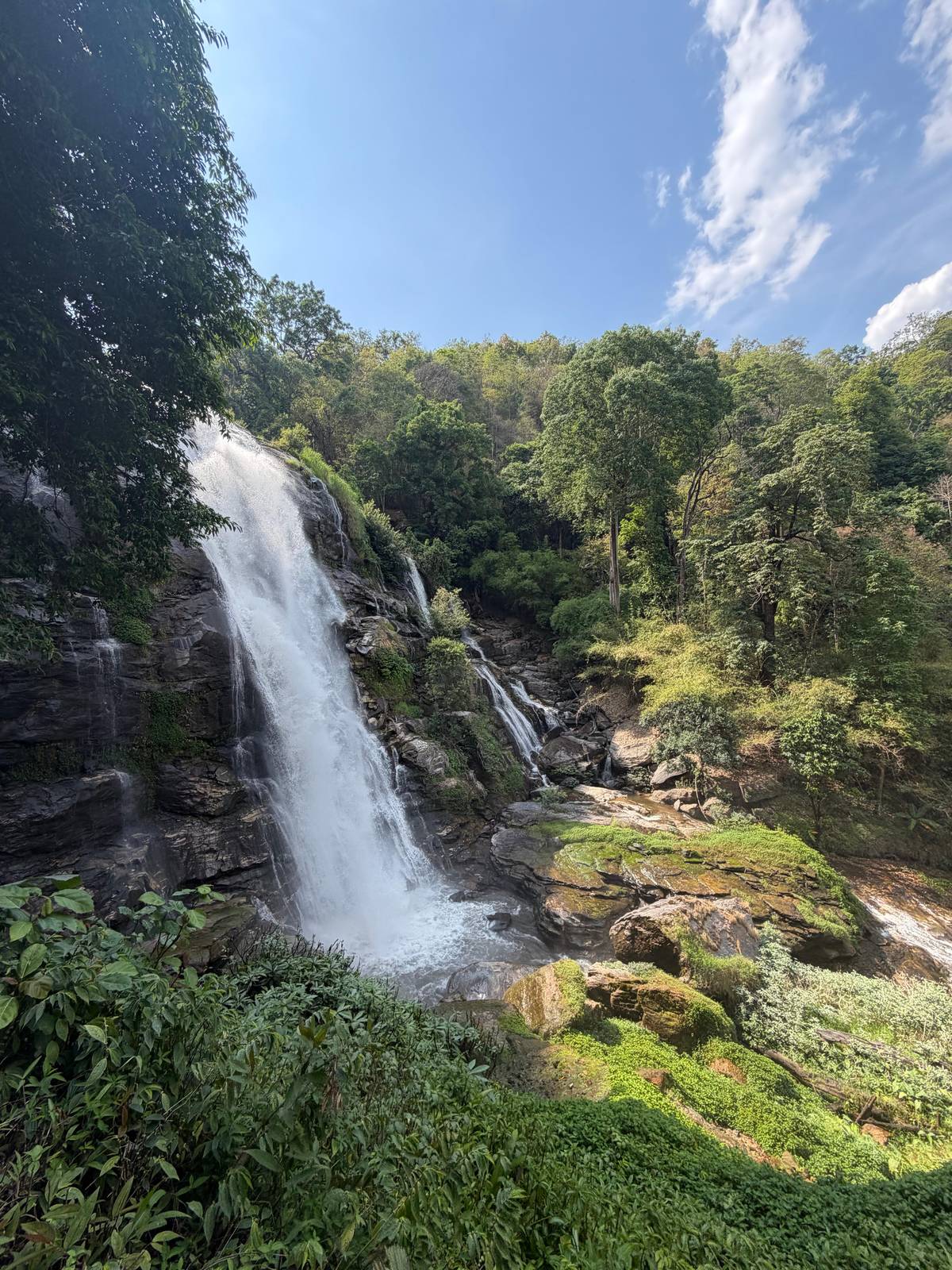
cascading down over its 30 tiers, approximately 260 meters in height. It is regarded as Thailand's most beautiful waterfall.
Mae Ya Waterfall at Doi Inthanon
Mae Ya Waterfall at Doi Inthanon is the tallest of the park's falls and, in the park service's words, regarded as Thailand's most beautiful. It cascades down 30 tiers with a total height of approximately 260 meters.3 In the rainy season its width can reach 100 meters; in the dry season it carries less water but the streams run cleaner.17
It lies in the south of the park, off the main route. From a junction 1 kilometer up the Chom Thong road, you follow the left-hand road for about 14 kilometers.16 Check whether a group tour includes it before you book; if Mae Ya matters to you, your own transport or a private driver gives you the freedom to add it.
The fall is broad rather than narrow, a staircase of rock with water fanning across it, and it photographs best from a little distance. Give yourself time on foot around the base, and more if you want to sit and watch it. The road there passes farms and villages that most day-trippers never see, which is half the pleasure of the detour. Keep to the marked area: the rocks near the water stay slippery all year.
Map
From the old city to the roof of Thailand
First the hills around Chiang Mai where the treks and hikes go, then Doi Inthanon with its summit, pagodas, trails and falls.
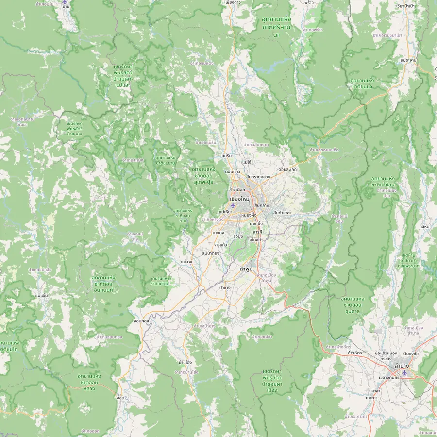 1Chiang Mai old city3Doi Suthep temple5Thailand's highest summit6Mae Wang7Mae Kampong
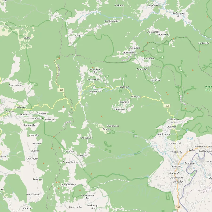 8Summit stupa9Twin pagodas and Kew Mae Pan11Pha Dok Siew12Mae Klang Luang13Siriphum Waterfall14Wachirathan Waterfall15Mae Klang Waterfall16Mae Ya Waterfall17Mae Pan Waterfall
- 1Chiang Mai old city
Start of the site tour: the meeting point is Baan Meesuk in the old town, with pickup available.
In Google Maps ↗ - 3Doi Suthep temple
Wat Phrathat Doi Suthep stands at 1,056 metres, an easy half hour drive from downtown.18
- 5Thailand's highest summit
The top of Doi Inthanon, at 2,565 meters.19
In Google Maps ↗ - 6Mae Wang
Mae Wang District is one of the districts Doi Inthanon National Park covers.20
In Google Maps ↗ - 7Mae Kampong
Ban Mae Kampong, a village in Mae On District, won the PATA Gold Award 2010 in the culture category.21
In Google Maps ↗ - 8Summit stupa
The stupa of King Inthawichayanon stands at the summit, linked to the visitor center by an elevated walkway.2223
In Google Maps ↗ - 9Twin pagodas and Kew Mae Pan
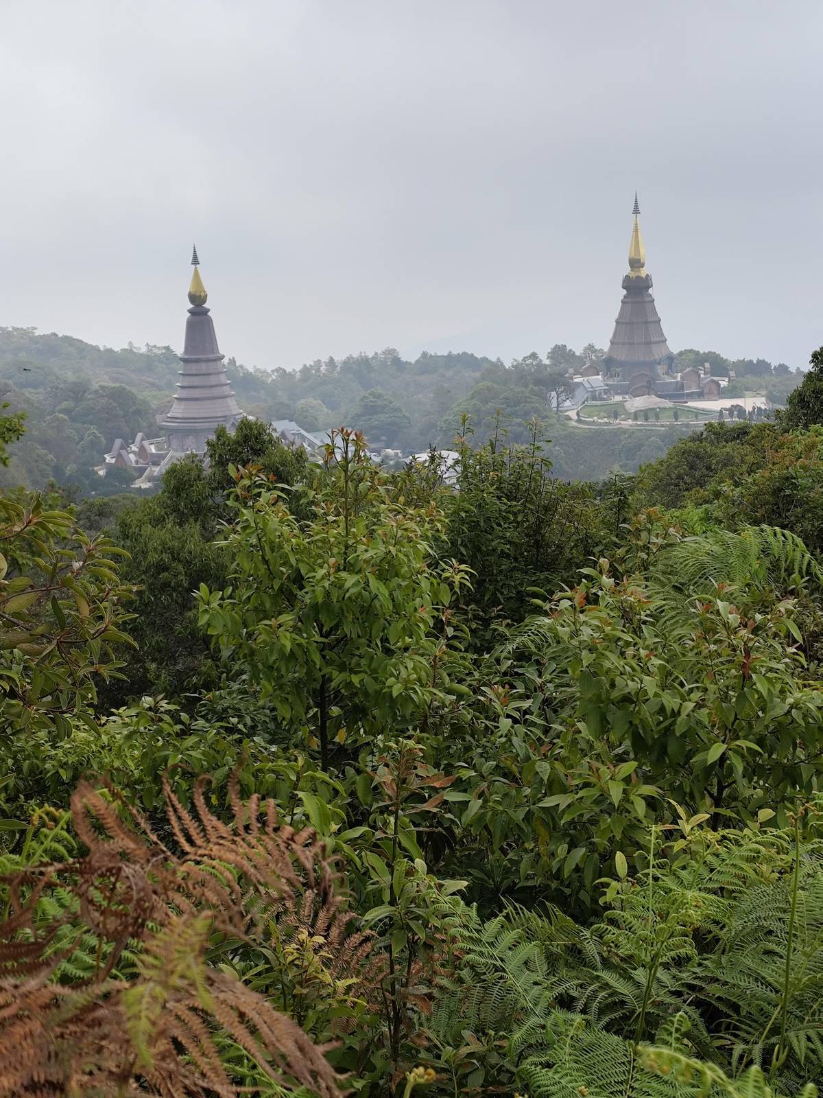
The Great Holy Relics Pagodas near the top; TAT lists give the nearby Kio Mae Pan Nature Trail as closed from 1 June to 31 October.242526
In Google Maps ↗ - 11Pha Dok Siew
Pha Dok Siao Waterfall has 10 tiers and lies about 1 kilometer on foot from the park headquarters.56
In Google Maps ↗ - 12Mae Klang Luang
Ban Mae Klang Luang, a hill tribe village on several Doi Inthanon day trips.
In Google Maps ↗ - 13Siriphum Waterfall
Twin falls reached on foot through the flower plots of the Inthanon Royal Project.12
In Google Maps ↗ - 14Wachirathan Waterfall
About 70 to 80 meters high, at milestone 20 of Highway 1009.12
In Google Maps ↗ - 15Mae Klang Waterfall
Flows all year into large pools; rainy-season currents make swimming perilous.4
In Google Maps ↗ - 16Mae Ya Waterfall
Thirty tiers and approximately 260 meters in height.3
In Google Maps ↗ - 17Mae Pan Waterfall
Four tiers and over 100 meters tall, about 400 meters on foot from the ranger station.15
In Google Maps ↗
Checklist
A day of waterfalls
01
Bring
- A dry bag for phone and camera
- Sandals or shoes with grip
- Towel and a change of clothes
- Cash for the park gate and food stalls
02
Remember
- No swimming in rainy-season currents
- No wading at Lan Sadet
- Arrive early, before the groups
- Trail falls can close in high water
Cost calculator
Price a waterfall day for your group
Add the number of people and a tour to total the cost.
People
Total from$77
each from $39
Check availabilityfree cancellationStarting prices come from GetYourGuide, converted with European Central Bank rates; booking reveals the exact figure.
Video
Wachirathan and Mae Ya, two waterfalls of Doi Inthanon
The video loads only when you tap play.
Mae Klang, Sirithan and the falls along the road
Mae Klang Waterfall, at the eastern edge of the park, is the first major fall on the way up. It flows year-round into large plunge pools suitable for swimming, but the park service warns that rainy-season currents make swimming perilous.4 A visitor center lies about 400 meters away on foot.27 Wang Khwai, about 67.7 kilometers from Chiang Mai, is known among families for its streams over a broad stone courtyard.28
Higher up, Sirithan Waterfall sits at milestone 22 at 870 meters: a two-tiered fall of around 50 meters over massive rocky cliffs.11 It was named by Queen Sirikit, who visited on March 28, 2002.29 At milestone 22, against Wachirathan's milestone 20, the two are easy to see together.112
Near Khun Klang, Siriphum Waterfall is two falls side by side over a steep cliff, reached on foot for about 1 kilometer through the flower plots of the Inthanon Royal Project.12 It was once named after a nearby Hmong village and later renamed in honour of the King and Queen; its grounds are now the Siribhum Royal Garden.30
Falls you reach on foot
Some of the best water on the mountain needs a walk. Pha Dok Siao Waterfall has 10 tiers, and the park service says the 6th to 10th tiers are the easiest to explore, about 1 kilometer on foot from the park headquarters.56 Guided trek days walk this trail; one describes it as a downhill path past several cascades and rice terraces.
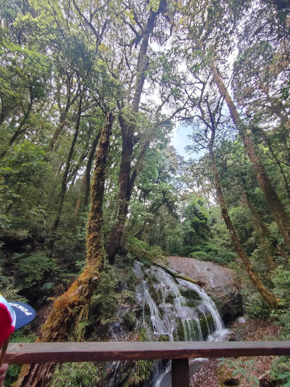
Lan Sadet is a small waterfall at the very start of the Kio Mae Pan Nature Trail, in shady moss forest, and wading there is not permitted.3132 Both trail and waterfall are closed from 1 June to 31 October in TAT's lists of seasonal closures.25 On the western side, Mae Pan Waterfall falls in four tiers over 100 meters tall, about 400 meters on foot from its ranger station.15
Trail waterfalls are the ones most affected by high water. In August 2019 the park closed the Pha Dok Siew trail and its waterfalls temporarily for safety, reopening once the water returned to normal.33 Check with your guide or at the headquarters before setting off in the wet months.
Linking the falls with the summit
A good waterfall day climbs the mountain and drops back down. Start at the top while the air is clear, with the summit stupa and the boardwalk, then work down the road: Siriphum through the Royal Project gardens, Pha Dok Siao from the headquarters, Sirithan and Wachirathan near milestones 22 and 20, and Mae Klang last on the way out.1261124
Doing it in that order puts the swimming stop at the end of the day, when the heat in the valley makes cold water welcome, and keeps the cooler, cloudier summit for the morning. The park service describes the upper highlands as wet and cold through the year, so you will want a layer at the top and sandals at the bottom.34
If you are on a guided tour, you will not set the order, but you can still use it to judge listings: a day that reaches the summit, a pagoda, one big fall and a village is a full day already. Adding Mae Ya on top usually means a private car.
Swimming, safety and health
Not every fall is for swimming. The park service describes Mae Klang's pools as suitable for a swim outside the rainy season, while wading is not permitted at Lan Sadet.431 One Doi Inthanon trek day states plainly that its waterfall stops are for looking, not swimming. When in doubt, follow the signs and the rangers.
Fresh water carries a health point too. The CDC warns that leptospirosis risk is higher after floods or heavy rainfall, and advises covering cuts with waterproof bandages around water.35 After a big storm, the safest choice is to enjoy the falls from the viewing platforms and save the swim for a drier day.
Wear sandals or shoes with real grip, not smooth flip-flops, for the wet rock around every fall. Bring a dry bag for your phone, a towel and a change of clothes if you plan to get in, and go early, ahead of the tour vans.
Your trek
Two days, one village night, one raft.
All meals, a group of 12 at most, and free cancellation until 24 hours before.


You ask,we answer.
Which is the highest waterfall on Doi Inthanon?
Mae Ya. The park service gives Mae Ya 30 tiers and a height of approximately 260 meters.3
How high is Wachirathan Waterfall?
About 70 to 80 meters. It drops around 70 to 80 meters at an elevation of about 750 meters.1
Can you swim at the Doi Inthanon falls?
At some, outside the rains. Mae Klang's pools suit swimming, but rainy-season currents make it perilous; Lan Sadet allows no wading.431
Do tours stop at Mae Ya Waterfall?
Check the listing. It lies about 14 km down a side road from the main route; with your own transport it is easy to add.16
Where is Wachirathan on the road?
At milestone 20. It is 81.2 km from Chiang Mai at milestone 20 of Highway 1009.2
When are the waterfalls fullest?
In the rainy season. Mae Ya can widen to 100 meters in the rains and runs cleaner in the dry months.17
Can waterfall trails close?
Yes, in high water. In August 2019 the park closed the Pha Dok Siew trail and waterfalls temporarily for safety.33
Sources
What this text is based on
- 1Department of National Parks, Wildlife and Plant Conservation (DNP), ThailandWachirathan Waterfall - Doi Inthanon National Park↩
- 2Department of National Parks, Wildlife and Plant Conservation (DNP), ThailandWachirathan Waterfall - Doi Inthanon National Park↩
- 3Department of National Parks, Wildlife and Plant Conservation (DNP), ThailandMae Ya Waterfall - Doi Inthanon National Park↩
- 4Department of National Parks, Wildlife and Plant Conservation (DNP), ThailandMae Klang Waterfall - Doi Inthanon National Park↩
- 5Department of National Parks, Wildlife and Plant Conservation (DNP), ThailandPha Dok Siao Waterfall - Doi Inthanon National Park↩
- 6Department of National Parks, Wildlife and Plant Conservation (DNP), ThailandPha Dok Siao Waterfall - Doi Inthanon National Park↩
- 7Department of National Parks, Wildlife and Plant Conservation (DNP), ThailandDoi Inthanon National Park↩
- 8Department of National Parks, Wildlife and Plant Conservation (DNP), ThailandDoi Inthanon National Park↩
- 9Department of National Parks, Wildlife and Plant Conservation (DNP), ThailandDoi Inthanon National Park↩
- 10Department of National Parks, Wildlife and Plant Conservation (DNP), ThailandWachirathan Waterfall - Doi Inthanon National Park↩
- 11Department of National Parks, Wildlife and Plant Conservation (DNP), ThailandSirithan Waterfall - Doi Inthanon National Park↩
- 12Department of National Parks, Wildlife and Plant Conservation (DNP), ThailandSiriphum Waterfall - Doi Inthanon National Park↩
- 13Department of National Parks, Wildlife and Plant Conservation (DNP), ThailandWachirathan Waterfall - Doi Inthanon National Park↩
- 14Department of National Parks, Wildlife and Plant Conservation (DNP), ThailandWachirathan Waterfall - Doi Inthanon National Park↩
- 15Department of National Parks, Wildlife and Plant Conservation (DNP), ThailandMae Pan Waterfall - Doi Inthanon National Park↩
- 16Department of National Parks, Wildlife and Plant Conservation (DNP), ThailandMae Ya Waterfall - Doi Inthanon National Park↩
- 17Department of National Parks, Wildlife and Plant Conservation (DNP), ThailandMae Ya Waterfall - Doi Inthanon National Park↩
- 18Tourism Authority of Thailand (TAT Newsroom)Exploring Chiang Mai's many natural and man-made wonders (May 2021)↩
- 19Department of National Parks, Wildlife and Plant Conservation (DNP), ThailandDoi Inthanon National Park↩
- 20Department of National Parks, Wildlife and Plant Conservation (DNP), ThailandDoi Inthanon National Park↩
- 21Tourism Authority of Thailand (TAT Newsroom)Thailand reaffirms its commitment to promoting responsible tourism (February 2016)↩
- 22Department of National Parks, Wildlife and Plant Conservation (DNP), ThailandDoi Inthanon Summit - Doi Inthanon National Park↩
- 23Department of National Parks, Wildlife and Plant Conservation (DNP), ThailandDoi Inthanon Summit - Doi Inthanon National Park↩
- 24Tourism Authority of Thailand (TAT Newsroom)TAT advises tourists to Northern Thailand to take precautions amid air quality concerns (25 March 2019)↩
- 25Tourism Authority of Thailand (TAT Newsroom)Opening/closed status of Thailand's national parks (July 2023)↩
- 26Tourism Authority of Thailand (TAT Newsroom)Thailand's national park system starts annual seasonal closure of attractions (April 2018)↩
- 27Department of National Parks, Wildlife and Plant Conservation (DNP), ThailandMae Klang Waterfall - Doi Inthanon National Park↩
- 28Department of National Parks, Wildlife and Plant Conservation (DNP), ThailandWang Khwai Waterfall - Doi Inthanon National Park↩
- 29Department of National Parks, Wildlife and Plant Conservation (DNP), ThailandSirithan Waterfall - Doi Inthanon National Park↩
- 30Department of National Parks, Wildlife and Plant Conservation (DNP), ThailandSiriphum Waterfall - Doi Inthanon National Park↩
- 31Department of National Parks, Wildlife and Plant Conservation (DNP), ThailandLan Sadet Waterfall - Doi Inthanon National Park↩
- 32Department of National Parks, Wildlife and Plant Conservation (DNP), ThailandLan Sadet Waterfall - Doi Inthanon National Park↩
- 33Tourism Authority of Thailand (TAT Newsroom)Doi Inthanon National Park announces emergency closure (11 August 2019)↩
- 34Department of National Parks, Wildlife and Plant Conservation (DNP), ThailandDoi Inthanon National Park↩
- 35US Centers for Disease Control and Prevention (CDC)Thailand: Traveler view (Travelers' Health)↩